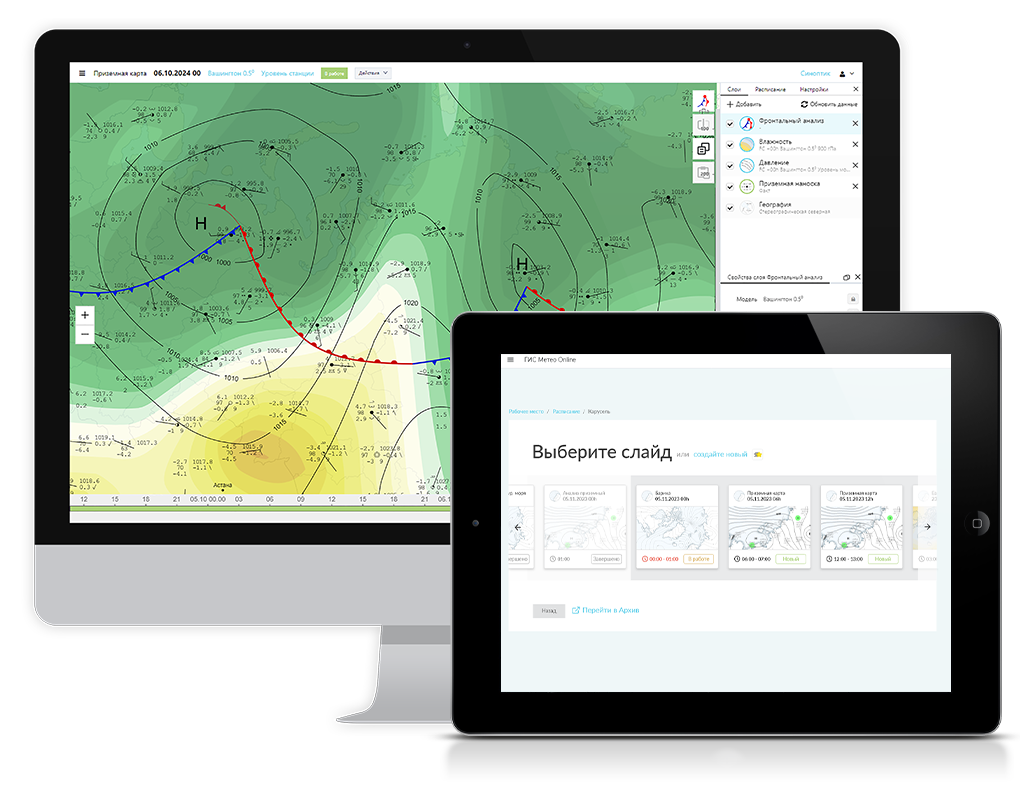
GIS METEO ONLINE
A modern tool for professional meteorologists. The online version of the GIS Meteo software.
EASY TO USE
The product is implemented using the web technology, which allows working in «server-client» interactive mode using any modern browser without installing special software to the meteorologist’s workstation in Windows, Linux, and Mac OS. Most modern platforms are supported by the client-server architecture. The reception and processing of data take place on the server to which client devices are connected, that display data and process user actions. Since the main load falls on the server, the client application operates fast enough. You can work with our server via the Internet or deploy your own server in a corporate network and work in the intranet.
OPERATING CHARACTERISTICS
The reception, decoding, recording to the database and basic calculations are performed on the server side. The client side controls data selection parameters, interpolation accuracy, etc. The data are recalculated in real time.
INCREASED DATA PROCESSING SPEED
The latest developments in the field of data analysis and interpolation are used to increase data processing speed.
PRODUCT DESCRIPTION
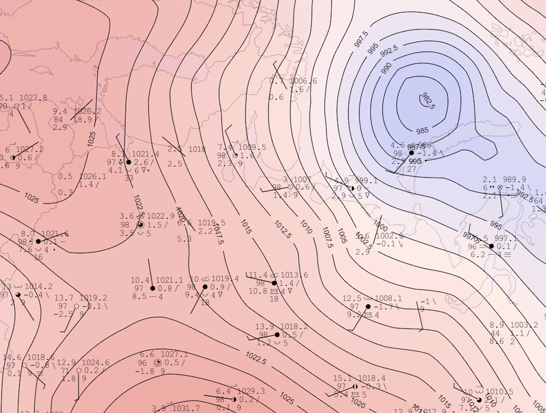
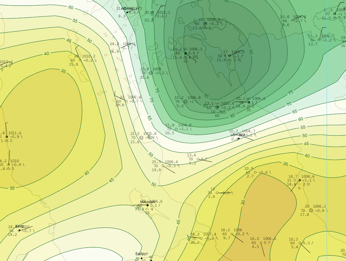
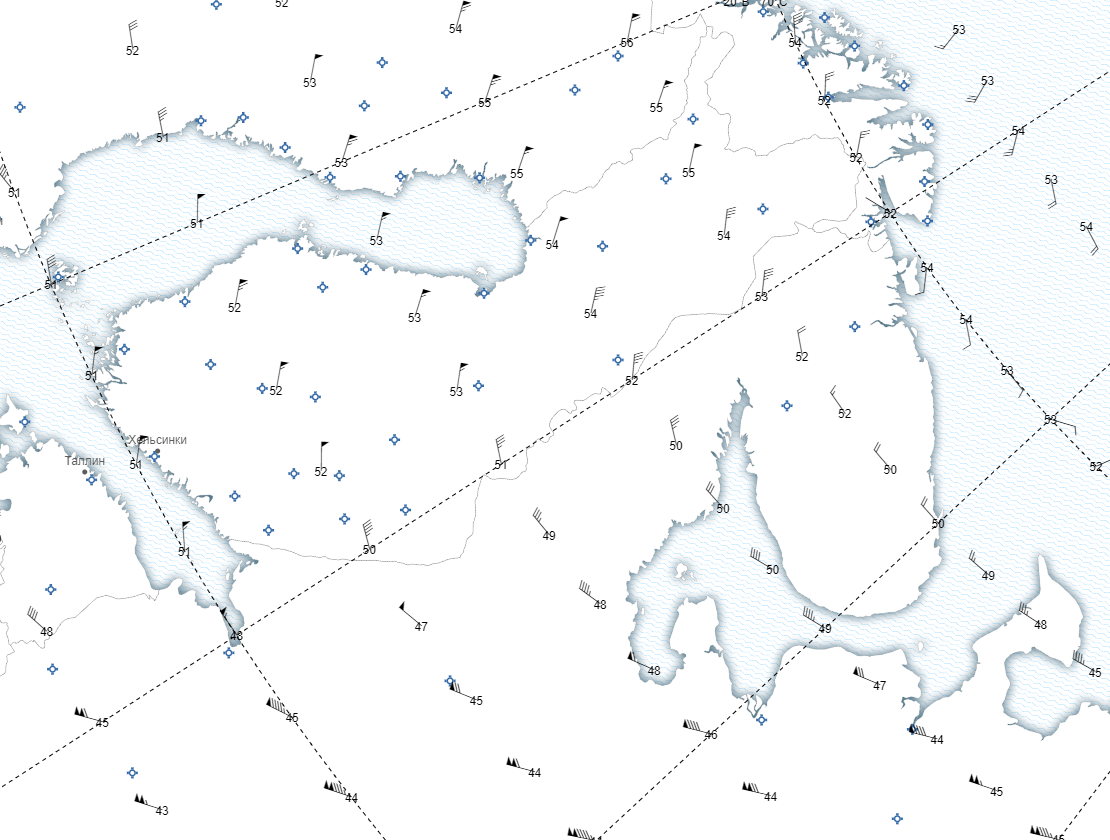
The GIS Meteo Web software package is designed for operational reception, processing, and visualization of meteorological data on the geographic map using web technologies.CREATION AND ANALYSIS OF WEATHER MAPS
The package allows creating and analyzing weather maps in real time using data from specialized sources of meteorological information. When creating maps, a detailed tile base is used for the stereographic projection and Mercator projection, which allows an accurate georeferencing and does not interfere with the analysis of meteorological data.
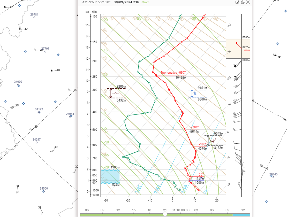
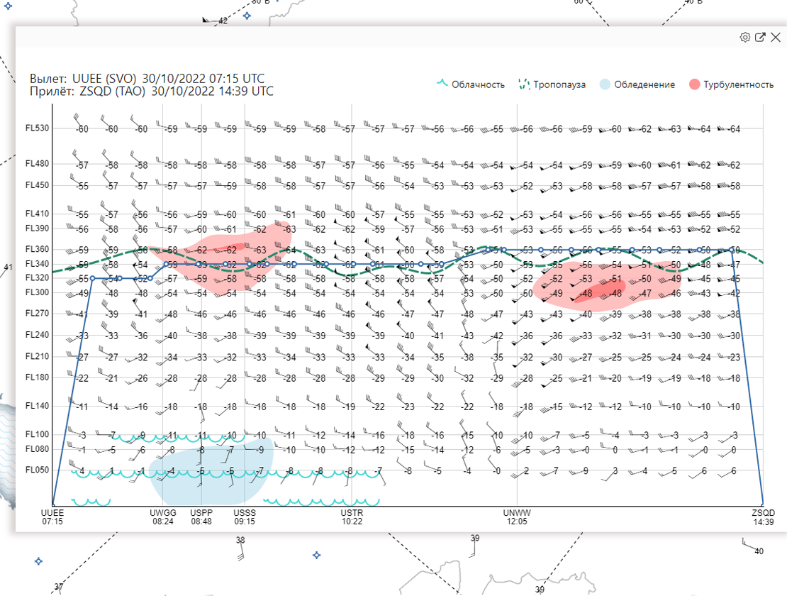
PRODUCTION OF FORECAST CALCULATIONS
The package allows you to perform forecast calculations in the boundary layer and the free atmosphere, to create any weather maps based on the WMO GTS data.
CREATION OF MAPS
Creating and editing weather maps for any region of the globe.
BROWSER-BASED OPERATION
It does not require installing the software, it operates via the browser.
FRIENDLY INTERFACE
The package has a user-friendly interface developed with participation of leading designers, many actions are taken in 2-3 clicks. Now the slide is not limited to the selected territory. You can move to any point of the globe and then come back using the recent history
OPERATIONAL DATA
The application works with operational data, there is an option of loading new data during the work.
MULTILANGUAGE
The application interface supports Russian and English languages. The switching occurs without restarting the application.
PRINT TO PDF
The application exports maps in PDF format, which allows printing maps of any size without losing the image quality.
SCALABILITY
As the scale increases, the data are recalculated with higher accuracy for a specific zoomed area of the map.
MAP ARCHIVE
All created user maps and data for them are stored on the server.
AUTOMATION OF WORK
It is possible to create forms and map templates for any user, which automates the meteorologist’s work.