Flight Level hardware and software complex
Flight Level hardware and software complex - is a complex of software and hardware designed to control the altitude of aircraft. This complex allows you to calculate the height for preset flight level using the standard atmosphere or geometric height measured using GPS or GLONASS
CAPABILITIES
- Temperature;
- Wind speed and direction;
- Pressure;
To perform calculations, ESHELON uses interpolation tools and standard atmosphere formulas. Values are calculated for the specified coordinate, altitude, and time.
Pressure can be calculated for a standard atmosphere or for a real earth atmosphere.

INTERACTION WITH THE SYSTEM
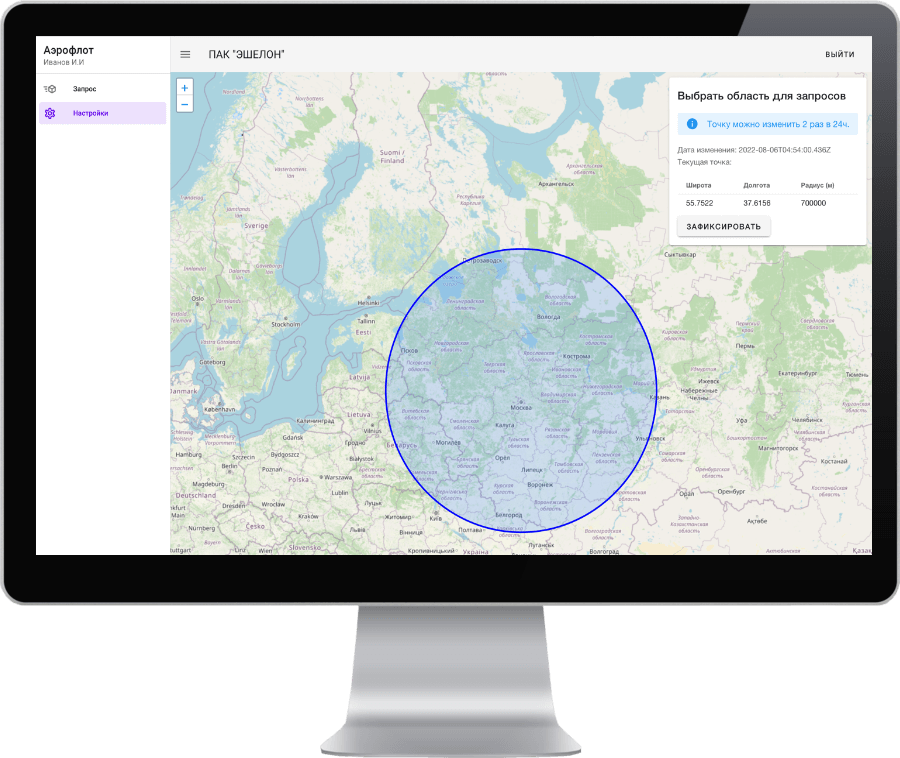
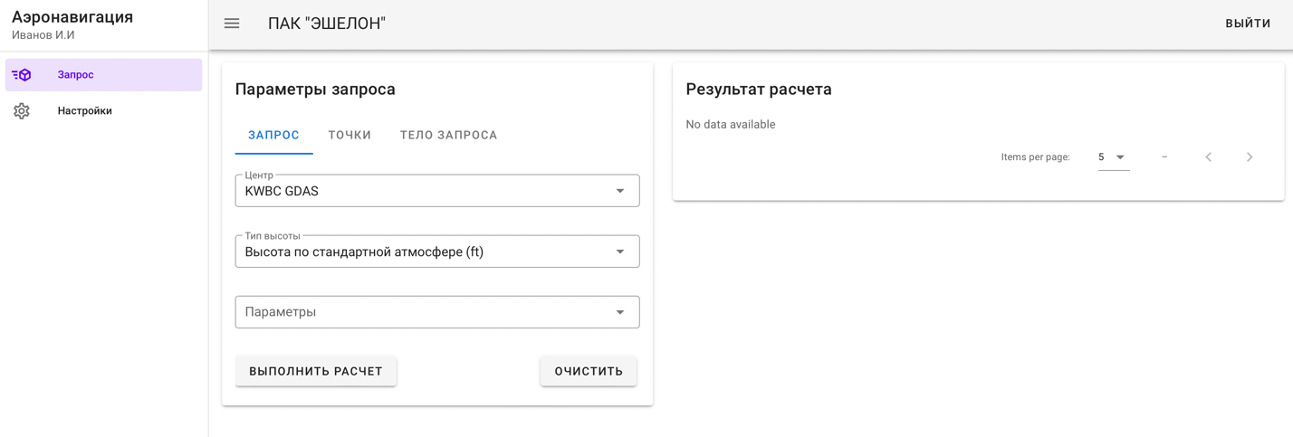
- A convenient web-interface was developed for interaction with the system. It allows you to perform calculations and administration of the service - access control and user settings control.
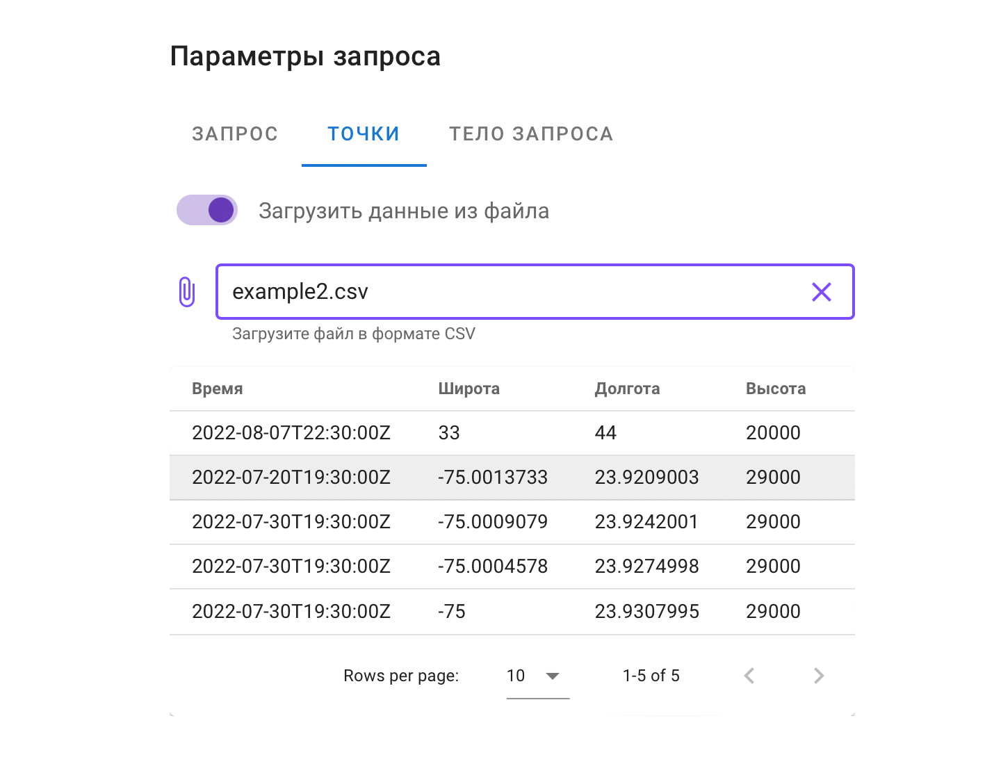
- Calculation can be done both manually by adding each point sequentially through the input form. And semi-automatically, by loading pre-prepared data from a csv file
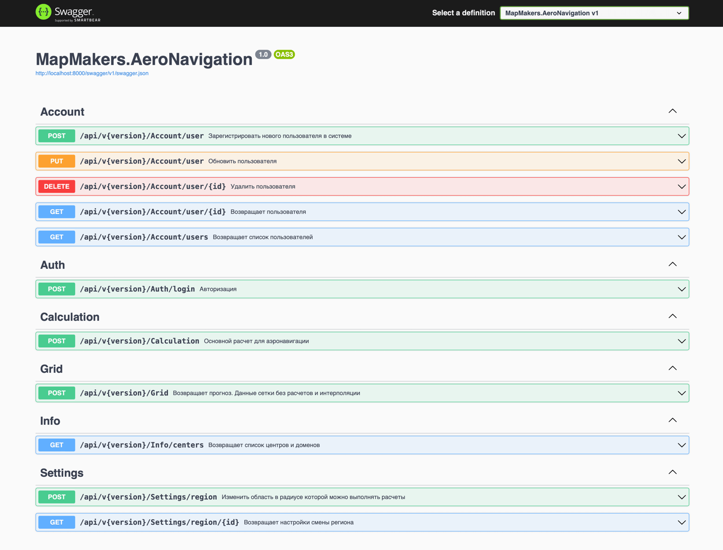
- The service provides a public REST API for performing various operations: data calculations, user registration, request territory settings, etc