AN AUTOMATED WORKSTATION OF AN ECOLOGIST
- assess the amount of the hazardous substance released into the atmosphere as a result of full destruction of the reservoirs, in which the hazardous substance can be stored in the gas and/or liquid state;
- define the size of polluted areas and localities from several sources of the hazardous substances released into the atmosphere;
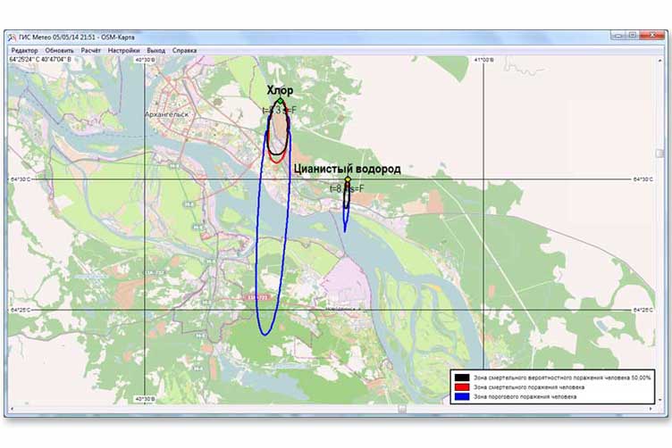
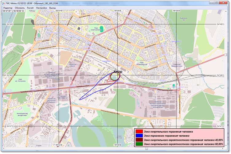
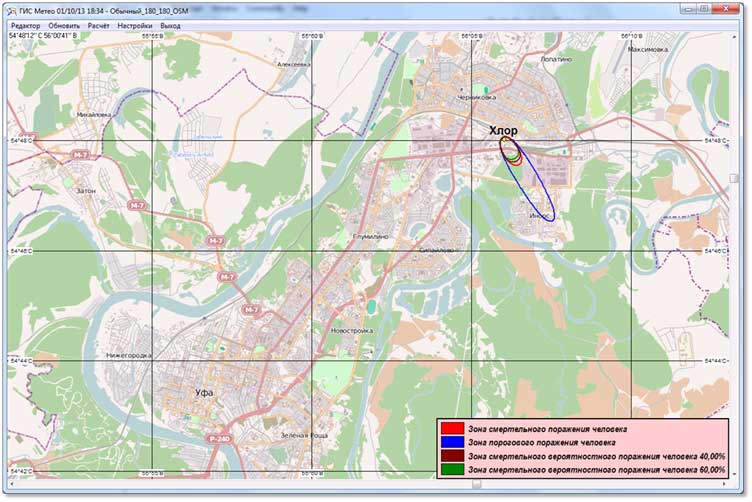
- assess and visualize the consequences of the hazardous substances released in accordance to the meteorological conditions;
- support and assist the automated mode of the meteorological data updating;
- display the calculated impact zones on the slides of the GIS Meteo software.
TOXI+GIS Meteo software is recommended for:
manufacturing facilities
designing manufacturing facilities, where hazardous substances and wastes are produced, used, processed, generated, stored, transported, disposed of;
developing measures
developing measures for the personnel and population protection from accident consequences;
Forecasting
Forecasting accident consequences at hazardous production plants in depend on the actual and predictive meteorological situation.