GIS METEO Forecaster-analyst software
Automated workstation of a forecaster solves the following tasks:
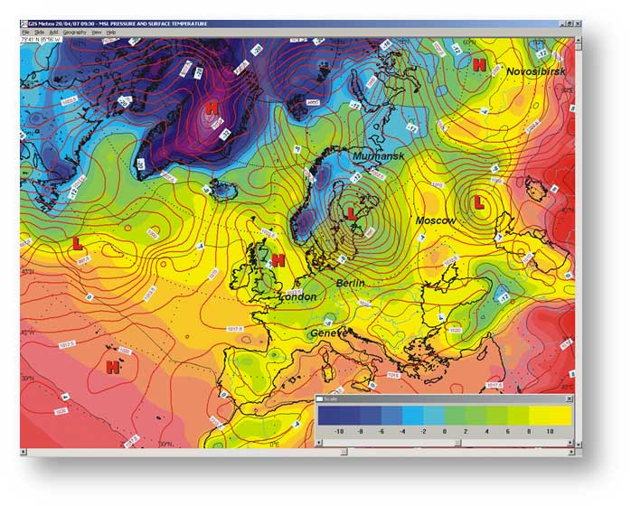
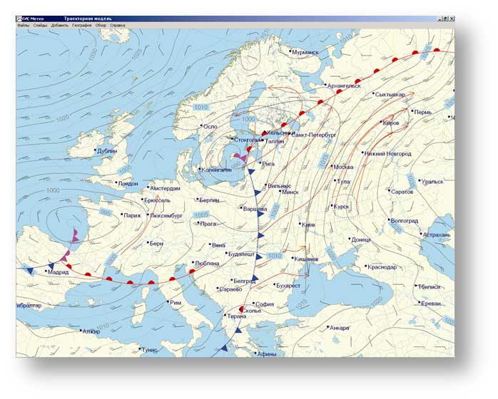
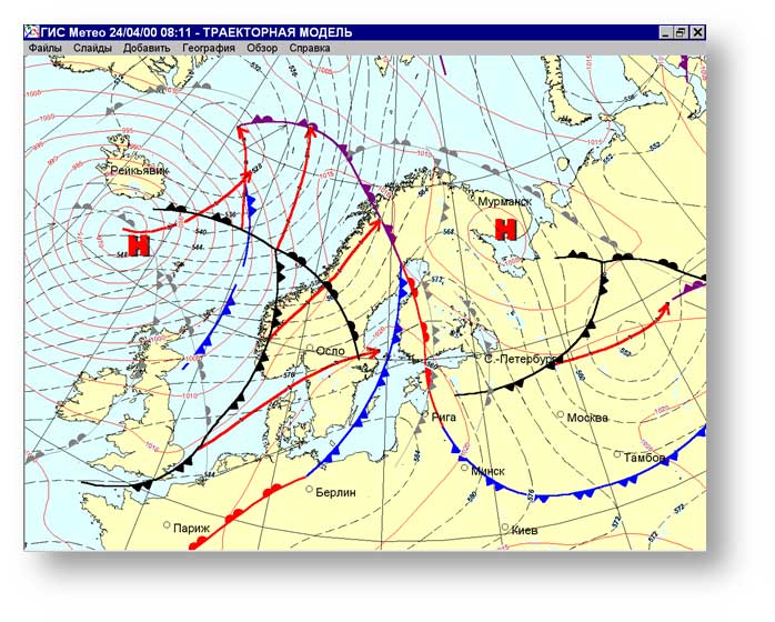
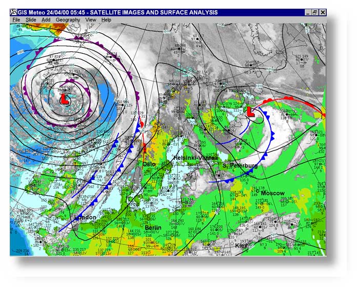
- Analysis of surface and high-altitude weather maps
- Forecast of formation, evolution and movement of pressure systems and fronts
- Evaluation of the quality of forecasts from various sources
- Medium-term forecasting for the specialized services in various industries
- Verification of prognostic fields on the basis of synoptic and statistical data.
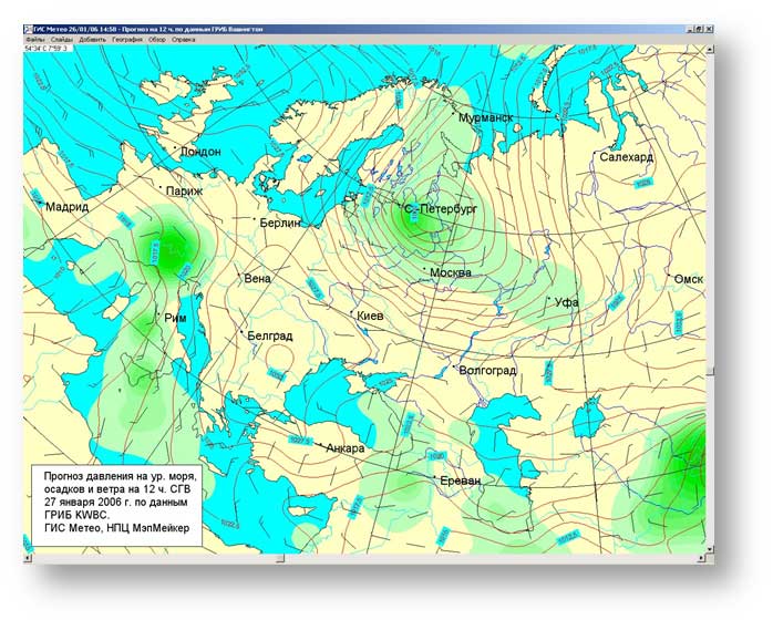
FORECASTS
GIS Meteo Synoptics software allows you to forecast:
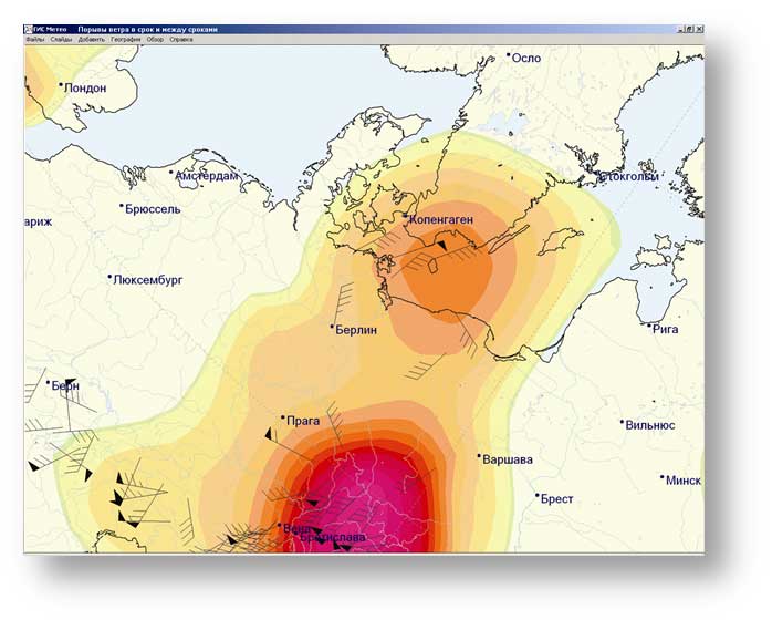
- surface wind
- surface air temperature
- surface humidity
- cloudiness
- precipitation
- fog and visibility
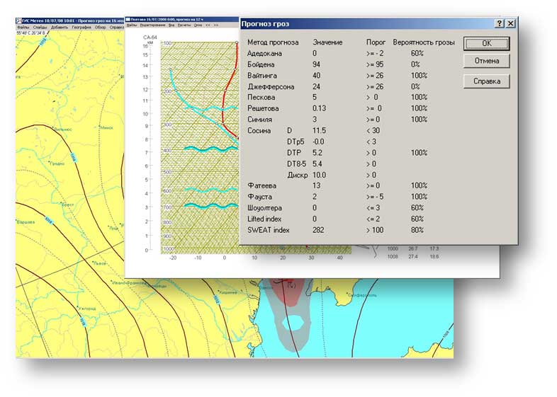
- severe weather and natural disasters
- fire hazard
NOWCASTING
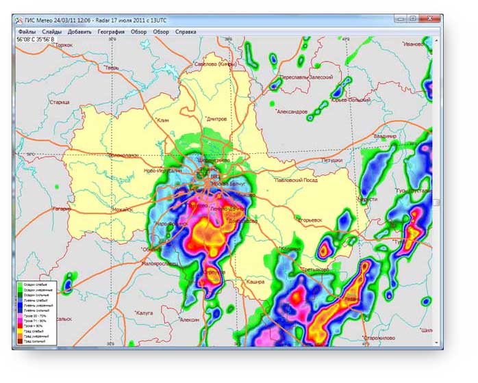
The combination of mesoscale forecasting models, data of observation stations and of weather radars enables short-range forecasting of dangerous and adverse weather events (storms, hail, thunderstorms, gusts) with a time length of 4-6 hours.
FEATURES
Some featuresCLIMAT code form
Data of code forms CLIMAT can be used for medium- and long-term forecasts.
EVALUATION OF FORECAST QUALITY
Special application of GIS Meteo software allows you to assess the quality of forecasts from different sources
RADAR
GIS Meteo software can work with the data of weather radars.