
Automated Pre-flight Information System in GIS Meteo technology
Automated Pre-flight Information System in GIS Meteo technology is designed to provide information exchange in the field of specialized meteorological support aircraft using web technologies. Demo access to the system : APFIS
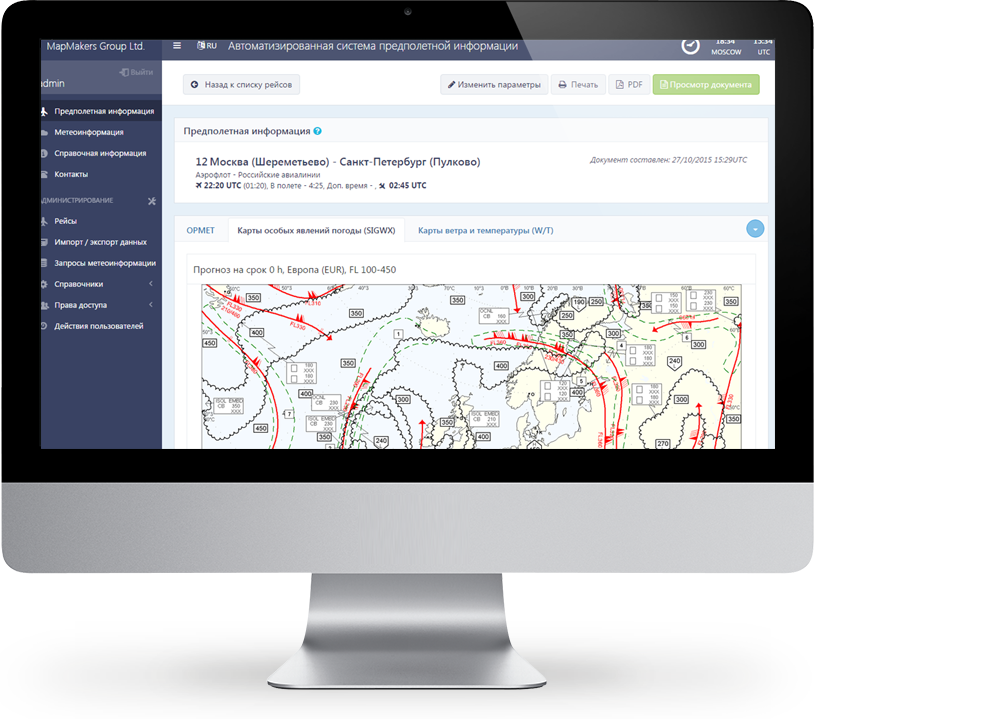
FORMATION OF FLIGHT DOCUMENTATION
Formation of a package of flight documentation with the ability to operatively make changes to the shedule or route
INTERACTIVE MODE
Recieving flight documentation for a flight out of a schedule, generating a route based on similar routes in interactive mode
PRINT AND EXPORT TO PDF
An ability to print and export to PDF format with saving a copy of the issued flight documentation
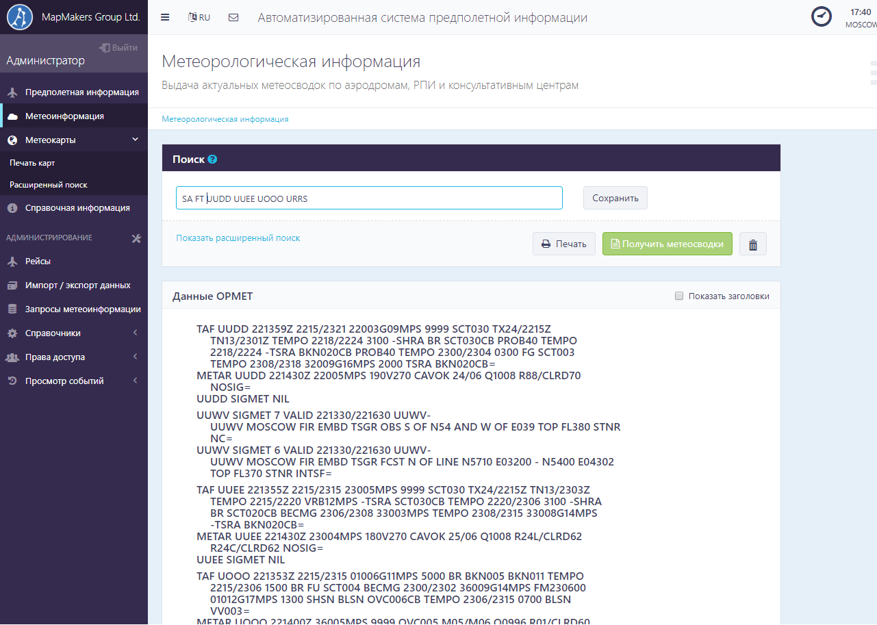
PROVIDING METEOINFORMATION
A tool for the operative providing of a set of currently relevant meteorological information with the possibility of an advanced search and query mechanism
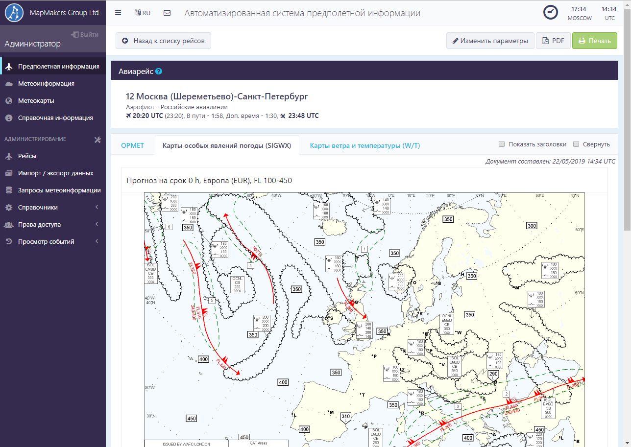
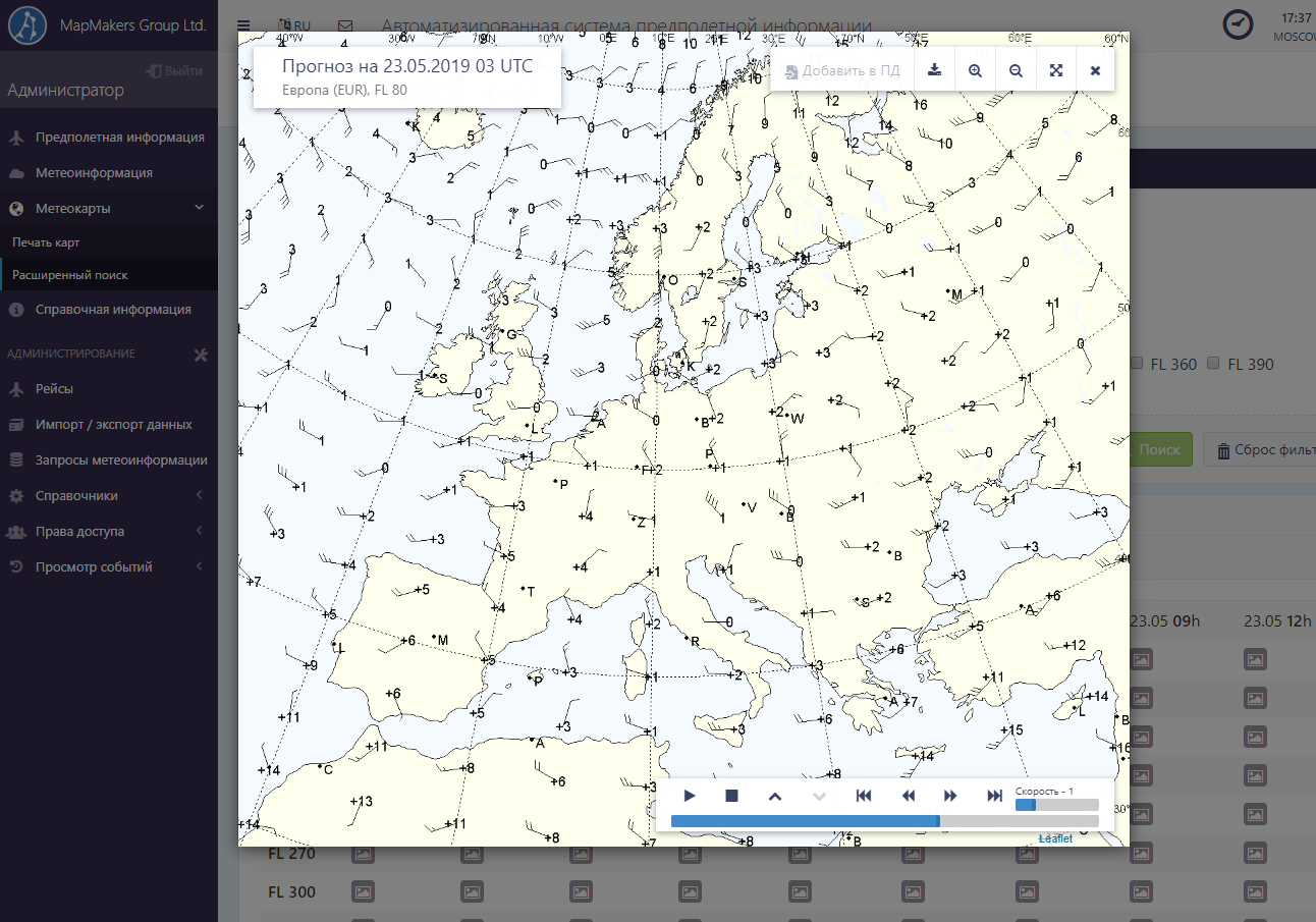
GALLERY OF PROGNOSTIC MAPS
An ability of advanced searching for prognostic maps, preview, automatically playing and adding maps to the flight documentation kit
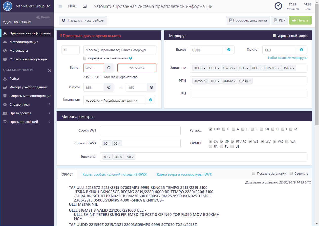
KEEPING A DATABASE OF FLIGHTS
A tool for keeping a database of flights, schedule and routes, setting the request parameters of meteorogical information
AUTHORIZATION AND AUTHENTIFICATION
Authorization and authentication, differentiation of access rights to a schedule of flights and routes, restriction within the entire system, aerodrome or airline
CONTROL OVER USERS
Control of user actions in the system, the ability to view previously issued flight documentation
SYSTEM HEALTH MONITORING
A tool for monitoring application control, obtaining OPMET data, generating a set of meteorological maps with timely notification the administrator about errors
METEOROLOGICAL DATA
Data that provides GIS Meteo AIS:- wind and air temperature forecasts and special weather phenomena forecasts;
- regular and irregular reports, as well as aerodrome weather forecasts;
- consultative messages about volcanic ash and tropical cyclones;
- weather forecasts for flight areas;
- special board reports;
- aerodrome and wind shear warnings.
ADVANTAGES
EFFICIENCY
The developed system allows to optimize the process of flight documentation compilation and providing it to the crews of aircraft due to the multifunctional and convenient interface
EFFECTIVE COMMUNICATION
The system helps to reduce the time spent on information provision of operational and production activities in the aviation sector due to centralized access and cross-platform
COST REDUCTION
GIS Meteo AIS allows to reduce the costs associated with the training of employees, organization of workplaces and rental of premises for the provision of meteorological information to users, including through the possibility of self-service flight crew